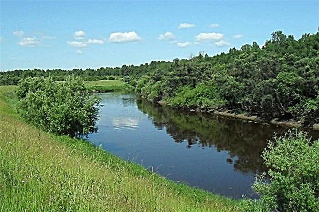
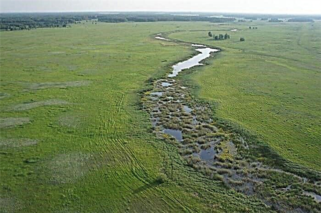
The Novosibirsk region is rich in water bodies. In total, there are 430 rivers on its territory with a length of more than 10 km, of which 21 rivers have a length of more than 100 km. The largest of them are Ob and Om. There are also more than 3 thousand lakes in the region. Most of the rivers originate from the Vasyugan swamp - this is the world's largest swamp formation with a total area of more than 53 thousand km².
Many of the rivers are known for passing through nature reserves. These are unique ecosystems where you can see many species of rare animals and plants. The rivers are rich in fish, therefore fishing is developed on them. On the banks of the rivers of the Novosibirsk region there are also traces of the sites of ancient people - archaeological sites of the Stone and Bronze Ages. The names of the rivers come mainly from the Ket and Turkic languages of the first inhabitants of this area.
The longest rivers of the Novosibirsk region
List of the region's largest waterways.
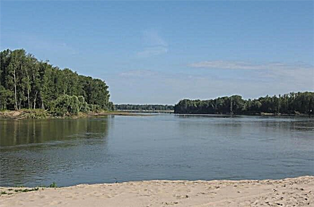
Ob
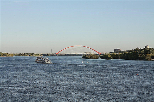
It is one of the largest rivers in the world. The Ob was first depicted on the map in 1542, but it was also mentioned earlier - in 1188 its lower tributary was included in the "subjects of the Obdorsk volost" of the Novgorod principality. The name of the reservoir comes from the words "snow" or "snow water" in the Komi language. The Ob is navigable along its entire length; the first steamship lines were created in the 19th century. Commercial fishing is developed on the river. The city of Novosibirsk is located on both banks of the river.
The length of the river is 3650 km, in the Novosibirsk region - 383 km.

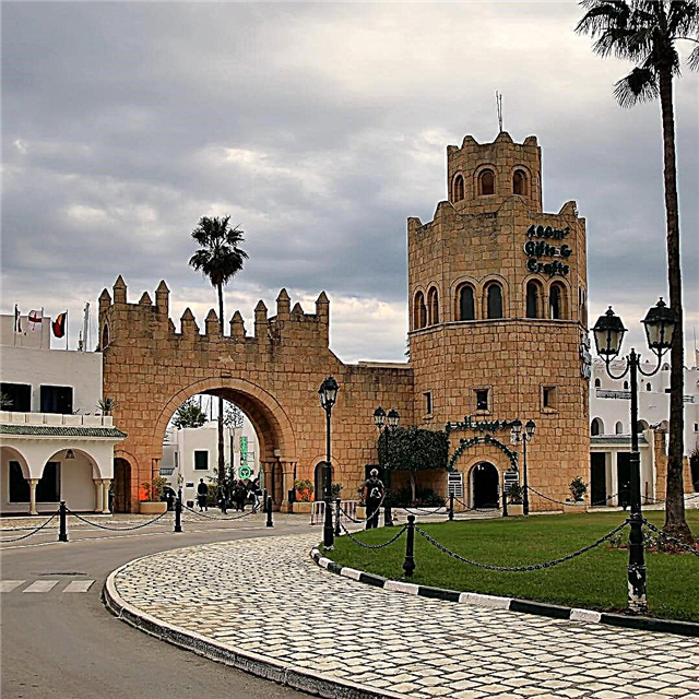
Don't Miss: 45 Top Attractions in Novosibirsk
Om
The city of Omsk got its name from this river. The river, in turn, got its name from the Turkic "om" - "quiet". Besides Omsk, the river flows through Kuibyshev and Kalachinsk. In the Soviet period, it was navigable; now it is not included in the list of inland waterways. Omi was first mentioned in 1701, in the Drawing Book of Siberia. Many archaeological sites have been found on the shores - sites and settlements, the earliest of which dates back to the Neolithic era.
The length of the river is 1091 km, in the Novosibirsk region - 827 km.

Container
This is the right tributary of the Irtysh River. The reservoir originates between the Ob and Irtysh, in the marshy lowlands. The river is navigable for 305 km, up to the village of Kyshtovka. Tara gave its name to the administrative center of the Tara district of the Omsk region. According to researchers, the name of the river comes from the Tatar word "tar" - "narrow".
The length of the river is 806 km, in the Novosibirsk region - 617 km.

Inya (lower tributary of the Ob)
The source in the Kuznetsk Basin, at an altitude of 256 meters above sea level, flows into the Ob. Belongs to the Verkhneobsk water basin. The name presumably comes from the Ket yen - long. There are 4 large cities on the Ina, including Novosibirsk. It also passes through many small settlements. Fans of the author and performer Yana Diaghileva know the river as the place where the rock singer died in 1991.
The length of the river is 663 km, in the Novosibirsk region - 234 km.

Tartas
This is a tributary of the Omi River. The source on the Vasyugan plain between the Ob and the Irtysh, the place where it flows into the Om is near the village of Stary Tartas. In the valley of Tartas, as a result of archaeological excavations, sites from the period of the 4th century BC were found. e. The name of the river consists of two Ket words: "tar" - "otter" and "tas" - "river". The interfluve of Tartas and Tara is rich in oil fields.
The length of the river is 566 km.
Karasuk
The river originates among the lakes of the Chulym region. The name has a Turkic origin: "kara" - "transparent" and "suk" - "river, water". On the river is the city of the same name, as well as the village of Krasnozerskoye, the villages of Petropavlovskoye and Kochki. In 2017, the vicinity of the source of the Karasuk River acquired the status of a specially protected area. The reason is their key role as a regulator of the aquatic ecosystem.
The length of the river is 531 km.

Chulym
The river originates among the Vasyugan bogs and flows through the territory of 5 districts of the Novosibirsk region until it flows into Lake Malye Chany. The name of the river comes from the Turkic "running snow". A large number of water birds live in the area of the source. The river crosses the Omsk-Novosibirsk section of the Trans-Siberian Railway.
The length of the river is 392 km.

Kargat
This is the right tributary of the Chulym River. The Kargat River flows through the territory of 4 districts of the Novosibirsk region. The direction of the current is southwest, parallel to the Chulym River. The rivers merge near the village of Chulym. Like many other rivers, Kargat gave its name to the city. The name comes from the Turkic "korgat" - "to protect". Probably, the river bank with its dense forests served as a refuge for the population from tax collectors.
The length of the river is 387 km.

Shegarka
This is a left tributary of the Ob, which originates on the Vasyugan plain. The river is navigable in its wide part 214 km from the mouth, then it is subject to overgrowth. It has many tributaries: Elovka, Ketla, Teterinka, Baksa and others. The river is home to many species of fish, including commercial ones - pike, ide, dace, perch. The probable origin of the name from the Selkup "sega" or "shega" is black.
The length of the river is 382 km, in the Novosibirsk region it is 162 km.

Bagan
The probable origin of the name is from the Indo-European "bagno" (swamp). The river does indeed flow through a swampy area. The source is the swamp of the same name. The river passes through the territory of 5 districts. The river also gave its name to one of the regional centers. Fishing on the river is developed, such fish species as crucian carp, gudgeon, perch, etc. are caught. In the upper reaches of the river (the Volchya Griva area), the most recent in the region and the most massive burial of mammoths was found.
The length of the river is 364 km.
Berd
The source of Berdi is located on the Salair Ridge, on the border of the Altai and Kemerovo regions. The river passes through the Novosibirsk region and flows into the Berdsky Bay (Novosibirsk reservoir). The total length is 363 km. The name of the city of Berdsk comes from the name of the river. The river is navigable to the town of Iskitim. On the bank of the river in the Iskitimsky district there is a natural reserve - Berdsk Rocks with rare species of animals and plants. In the city of Berdsk there is also a nature conservation area - the Berdskaya spit.
The length of the river is 363 km, in the Novosibirsk region - 274 km.

Cheka
Cheka or Chok flows in the Kyshtovsky district of the Novosibirsk region. The source is on the Vasyugan Plain, flows into the Tara River. There is a biological reserve Maizassky near the river. Also about the five lakes located along the Cheka, there is a belief that it is enough for a person with any illness to plunge into them one by one - and a person leaves the fifth lake recovered. Therefore, the lakes are called "saints" or "with living water."
The length of the river is 295 km.

Icha (lower tributary of the Omi)
The name of the river comes from the Türkic word "ich" - "to drink". It passes through the territory of 4 districts of the Novosibirsk region and flows into the Om along its right bank 584 km from the mouth of the Omi. Like other rivers in the region, Icha belongs to the Irtysh water basin. It passes through the industrial Kuibyshevsky district, therefore it is prone to pollution. Both the upper tributary of the Omi and the tributary of the Tara bear the name Icha.
The length of the river is 257 km.

Kama (tributary of the Omi)
It originates in Lake Pichurla (Chumgan swamp), flows through the territory of 3 districts of the region and flows into the Om along its right bank at a distance of 529 km. from the mouth. Sometimes the river is confused with the reservoir of the same name in the European part of Russia, but the length of the Kama river in the Novosibirsk region is much shorter, and it has no significant tributaries. A network of reclamation canals runs along the river. The name is presumably of Finno-Ugric origin, from "kama" - "big river".
The length of the river is 222 km.

Bucks
Right tributary of the Shegarka River. It begins on the territory of the Tomsk region, from the Baksinsky swamp. It flows through many small settlements. The shores are rich in forests with a wide variety of flora and fauna; brown bear, muskrat, hares, black grouse and other species are found.Fishing is developed on the river - according to the reviews of fishermen, there are trophy pikes.
The length of the river is 206 km, in the Novosibirsk region - 152 km.

Baganenok
It originates in the village of Nizhnecheremoshnoye, Krasnozersky District, Novosibirsk Region, and falls into the Bagan River, hence the name. The river crosses many lakes. On the right bank of the Baganenok River, there is the Stepnaya Katena nature reserve with an area of 38.7 hectares. It is home to many species of animals and birds, 3 of which are endangered. Also included in the Red Book are 2 plant species.
The length of the river is 180 km.

Mayzas
Maizas flows through the territory of the Kyshtovsky district. On the shores there are deposits of peat and oil, brick loam. The forests are rich in conifers. This is where the name of the river in the Ket language comes from: "may" - "cedar" and "zas" - "river".
The length of the river is 168 km.

Suzun (Lower Suzun)
The river originates from the village of Shaidurovo in the Suzunsky region and flows into the Ob River along its right bank. The district center got its name from the river. The origin is Turkic, from "su" - water, and "zun" - forest, green. The river crosses with the West Siberian railway. Not far from the Suzun River, there are state-protected natural sites - the Splavnoye Lake nature reserves with an area of 100 hectares and the Suzunsky nature reserves with an area of 80 thousand hectares.
The length of the river is 132 km.
Ises
This is a tributary of the Tartas River. It has two tributaries - the Uguyka River and the Budaika River. The name is presumably Ket. It flows through the Kyshtovsky and Vengerovsky regions. Not far from the river, on the territory of the Vengerovsky district, archaeologists have found monuments of the Bronze Age - 3500 BC, these are traces of settlements and burials.
The length of the river is 121 km.

Uzakla
The name probably comes from the Turkic "uzak" - "long", although the length of the river is relatively short. The river flows into the Om along its right bank 644 km from its mouth. It flows in the territory of the Kuibyshevsky district. On the shores there are nature conservation areas - Kazatovsky and Mangazersky reserves. Commercial fish species are found in the river: pike, perch and other species.
The length of the river is 120 km.

Toya (tributary of the Baksy)
Like many other rivers in the region, it originates from a swamp: the Toyo Zaymishche. It flows into the Baksa River along the right bank, near the village of Ust-Toy. The river flows through the territory of the Kolyvan region, which is rich in lakes. The most famous among them is Minzelinskoe. The banks of the Toya River are rich in conifers. In spring, the water level in the river rises strongly, as in the Baksa river, which leads to floods.
The length of the river is 114 km.

Chick
The river crosses 3 districts - Kolyvansky, Ordynsky and Kochenevsky. At the confluence with the Oyosh River, it forms the Chaus River. The Chik River is rich in fish - gudgeon, perch, pike, carp and other species. The burbot, which was previously found in Chika, is now almost exterminated. Beavers and muskrats live in large numbers on the shores. Also, American minks that escaped from a fur farm in the village of Prokudskoye have taken root here. The river is known for the fact that in 1972 the film about the Great Patriotic War "Hot Snow" was filmed on its banks.
The length of the river is 114 km.

Suma (tributary of the Chulym)
The river takes its source in the Vasyugan bogs and flows into the Chulym river from the left bank, 222 km from its mouth. Crosses the Chulymsky and Kargatsky regions. There are deposits of peat and clay on the shores, which are used to make bricks. Many waterfowl live in the lowlands of the river.
The length of the river is 111 km.

Oyosh
The name comes from the Turkic word "oesh" - "stagnant, calm", according to another version - from the Turkic word "border". The river originates from the Prokop Oyosh canal and joins the Chik river along its left bank. Rare species of animals and birds are found on the shores - wolverine, reindeer, eagles and others.
The length of the river is 107 km.

Than
What (or Chom) takes its source on the Salair Ridge and flows into the Berd River along its right bank. The river flows through 2 districts - Toguchinsky and Iskitimsky. There are coal deposits on the shores, known since the 2nd half of the 19th century. Not far from the river Chem there is a nature conservation object - Ulantova Gora. This is a nature reserve with a mountain 407 meters high. 18 species of plants and animals living in the reserve are listed in the Red Book.
The length of the river is 96 km.