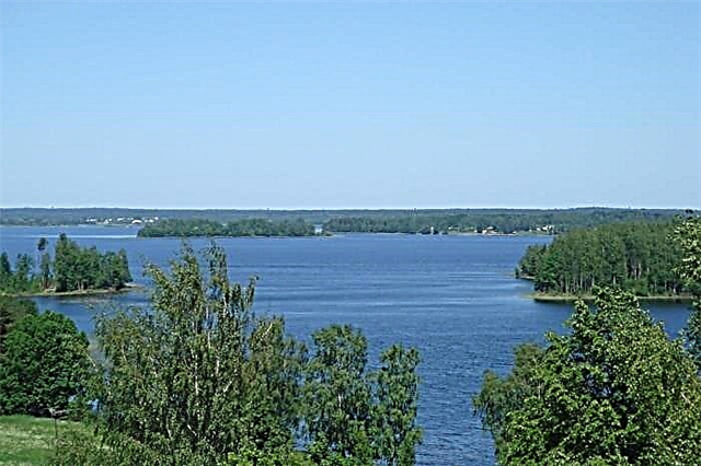
There are enough man-made attractions in the Novgorod region, so the tourism industry is developing systematically. The nature of the region is still lagging behind in terms of attracting guests. However, the beauty of the local lakes increasingly attracts hikers and fishermen. There are especially many reservoirs within the Valdai National Park. From one to the other - the distance is insignificant, so you can arrange an exciting tour with an extensive program.
The most visited lakes are Ilmen, Seliger, Valdai. They are chosen for vacations, and official events are not uncommon here. Travelers undeservedly ignore the Blue Lake. Its surroundings are fraught with a lot of interesting things: from an old manor house to a suspension bridge and elements of a long-destroyed mill.
The best lakes of the Novgorod region
The most famous and popular lakes in the region.
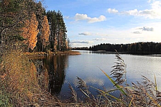
Ilmen
Located in the west of the region. The area is 982 km². The history of the development of the area goes back thousands of years. Ilmen is a dying body of water, in which active processes of siltation take place. Seasonal fluctuations in water level are 7 meters. The water has a brownish tint due to peat impurities, while remaining clean. There are good sandy beaches, although they are not well maintained. A tourist route to Lipno Island runs across the lake.

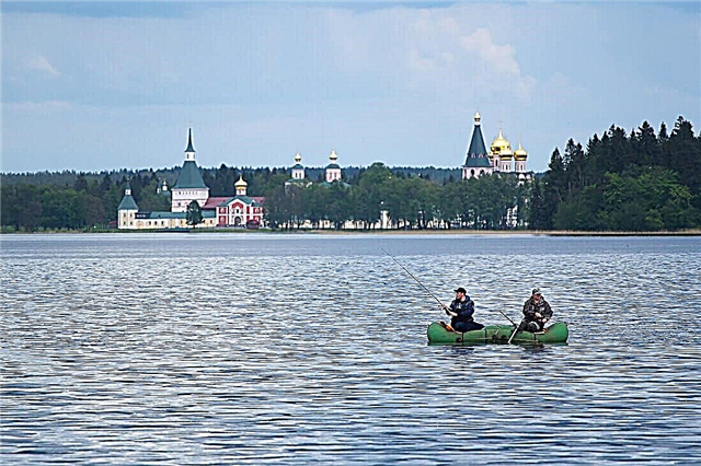
Valdai
Gave the name to the national park, of which it is. The area is 19.7 km². Ryabinovy Island divides the lake into two stretches. There are other picturesque islands as well as textured sandy beaches. The main attraction of the area is the Iversky Monastery. The complex of buildings was built on Rudnev Island at the turn of the 17th-18th centuries. In the 2000s, it was restored, an asphalt road and electrical networks were laid.

Velieux
It is part of the Valdai National Park. The area is 35 km². The depth difference is 42 meters. The bottom and banks are covered with sand, although there are also muddy areas. Unlike the populated western and northern shores, the southern and eastern shores are difficult to reach for vehicles. The water level in the lake is artificially raised thanks to a dam built on its drain. Veljo has over 200 islands.

Seliger
Refers to two regions at once: Tver and Novgorod. The area is 260 km². There are about 160 islands on the lake, and Khachin is the largest of them. The coastline stretches for more than 500 km. Tourist bases have been built, infrastructure for beach and outdoor activities has been developed. It gets busy during the season. Seliger hosts youth forums every year. A nearby attraction is the Novye Yeltsy estate.
Dinner (Dinner)
Another lake in the Valdai National Park. The area is 8.8 km². The maximum depth is 85 meters. The shape of the reservoir is so elongated that from a bird's eye view it resembles a river. In 1862, an artificial canal "Kopka" was built, connecting Dinner and Valdai. The initiator of its creation and the main financier was the Iversky Monastery. On the coast is the residence of the President of Russia.

Gorodno
Located in the Khvoininsky district. The area is 9.74 km². It is part of the "Karst Lakes" - a state nature reserve of regional significance. Gorodno has an interesting feature. Once every few decades, the water completely leaves the basin, and the bottom, covered with silt, turns into pasture. The villages in the area are home to a number of famous writers. Nikolai Sladkov dedicated one of his stories to the lake.

Borovno
It can be easily found in the Nevelsky district of the region The area is 1.8 km², the maximum depth is more than 10 meters. There are islands, mostly small ones. The bottom and beaches are muddy and covered with pebbles and stones, although there are also sandy areas. There are two villages on the coast. Borovno is part of the Ushcha river basin. The lake is considered a fish lake. In addition to pike, roach and perch, wide-fingered crayfish can be found here.
Sluggish
The name is given by the flowing river Vyalka. The area is 3.1 km². Refers to the river basin of the Neva. The recreation center "Olgino" was opened on the shore. The area is ecologically clean, there are no industrial or agricultural enterprises nearby. Fishing is allowed both from the shore and from the boat. Vacationers must bring their tackle with them, but boats are rented. Equipped with everything you need a beach and a pier.

Zaozerye
From here to Okulovka 7 km. The area is 8.37 km². Due to the abundance of plant plankton, the water is colored greenish. In the summer, for the same reason, the transparency of the water decreases, while in the rest of the time it is one and a half meters. The banks are covered with birch or mixed forest. The lake has islands of different sizes. There is good fishing in Zaozerye: bream, carp, perch are pecked.

Piros
Located in the border area with the Tver region. The area is 31.2 km², the maximum depth exceeds 11 meters. The northern coast is covered with dense forest, and the southern coast is swampy in places. There are several villages in the immediate vicinity. The Berezaika River flows through Piros. The reservoir is not as rich in fish as the neighboring lakes, but even novice fishermen can catch a small pike or bream.

Meglino
Located in the south of the region. The area is 24.2 km², the maximum depth is 23 meters. There are peat deposits on the western coast. The rest of the coast is covered with sand and pebbles, there are both steep and sloping sections. The connection with Lake Ostrovenskoye occurs through the Kanava River. And Meglino is connected with Brodskaya Lakhta by a channel. Since the lake is the largest reservoir in the area, the lands here are called Meglinskoe Poozerie.

Tigoda
Area - 8.1 km². There is a narrow-gauge railway nearby, which attracts fans of everything unusual. However, it is more and more difficult to get to the lake itself due to the thickets and the lack of normal dirt roads and hiking trails. The reservoir belongs to the Narva basin. Tourists rarely look in from afar, but the residents of the region explore the spaces in the vicinity of Tigoda with pleasure, constantly finding something new for themselves.

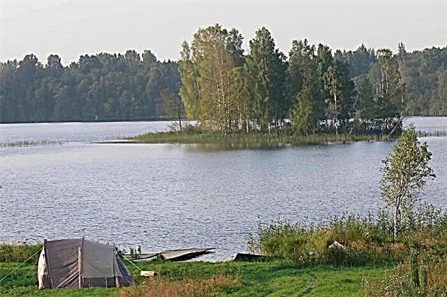
Ukleinskoe
Camping on the shore is a popular activity. There are plenty of places to set up a full-fledged camp. It is allowed to make fires, but cleaning up the trash after yourself is a must. Sandy beaches and comfortable depths help to relax in the bosom of nature. Access to Ukleinskoye is free, you can even drive a low car. Good fishing, even without bait.
Nikulinskoe
It is the source of the Ragushi River. The area is 4.2 km². Refers to the territory of the basins of the Neva River and Lake Ladoga. During the season, the lake attracts lovers of measured relaxation by the water. Fishermen and hunters also choose the Nikulinskoye coast to camp. Vacationers note some problems with mosquitoes and midges. But the water warms up quickly and is quite clean, although aquatic vegetation is found near the coast.

Shlino
It is spread over the Valdai Upland. Area - 34 km², maximum depth - 4.3 meters. The lake is owned by two regions at once: Novgorod and Tver. The shores are distinguished by an abundance of bays, capes, and sharp turns. The sites of ancient people dating back to the Neolithic period have been found in the area. Rare plant species grow on the coast. Schlino continues to be intensively studied by scientists from various fields.

Fiercely
Refers to the river basin of the Neva. The area is 3.7 km². The river Hadritsa flows out of the lake. In the XX century, Roerich and his team carried out active excavations near the coast. As a result of research, not only interesting artifacts were found, but also the existence of several legends was established. The locals believed that in ancient times giants lived with Luto, so huge that they could easily step over reservoirs.

Sheregodra (Zhukovskoe)
It is the source of the Sitnitsa River.The name Zhukovskoye was given to the lake by local residents. Area - 5.6 km². On the southeastern bank there is a manor where Suvorov lived for several years. Nowadays it has been turned into a museum-reserve. The reservoir has a rich tourist potential. In Soviet times, excursion tours passed through it, but now there is no such direction. Sheregodra is a protected natural area.

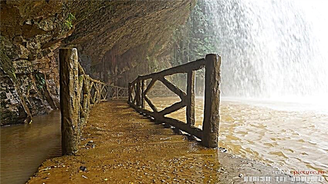
Blue
It is located in the Soletsky district. Despite the name, the waters of Blue Lake change color depending on the season. The reservoir has a spring origin, and the source gushing from the ground is salty. The flora on the banks has adapted well to soil salinity. The Gorki estate has been partially preserved. Also worth seeing are the surviving parts of the mill and a small dam, a flimsy but spectacular suspension bridge and sculptures.

Spasskoe
Alternative name - Peleno. Refers to in the Borovichi district. The area is 373 hectares, and the depth is up to 8 meters. In some areas, due to active exploitation, the reservoir began to overgrow. Baths and cottages are right by the water. There are several miniature marinas. The beaches are sandy and narrow. There are many fishermen, including boats. Several towers have survived, from which an excellent view of the lake opens.

Polonets
It is located a few kilometers from Seliger. Area - 2 km². Regarding recreation here, the data are contradictory. Fans of sport fishing mostly prefer other lakes, as there are better bites and more opportunities. And the locals go out on the ice of the reservoir even in winter. If you wish, you can find an overnight stay nearby or set up camp. People come here for photo shoots and to observe nature.

Migrating
Lake Okulovsky district of the region. The nearby town is about 10 km. The area is 3.8 km². Mosno connects Peretno with the Zaozerye reservoir. A recreation center of the same name has been opened on the coast. The list of services here is not too wide, but the rest is comfortable. Attractions nearby - the Church of the Holy Trinity, operating to this day, and the estate of the Musins-Pushkins, erected in the 18th century.

Somino
From Valday to the lake 15 km. There are no settlements directly on the coast. Area - 1.3 km². The depth is insignificant, there are areas where it does not exceed 2 meters. Somino is connected to Lake Piros through the river. Gradually, the reservoir is overgrown with algae and near-water vegetation. At the same time, the bite is good here, especially for pike and roach. The fishing season lasts all year round.

Linseed (End)
Natural and historical monument of regional significance. Local residents call the lake "Ends". Flax is fed by the river of the same name. The reservoir is elongated in shape: the length is about 8 km, and the width is up to 1 km. In addition to fish, crayfish are found. The shores are not uniform: high areas give way to narrow sandy beaches and swampy areas. The forests in the area are mixed, rich in mushrooms and berries.

Kamenskoe (Holy)
The alternative name "Holy" was received by the lake due to the burial near the coast of Saints John and James. Religious processions from nearby villages follow. Kamenskoye is surrounded by swamps on all sides. The Church of the Holy Trinity was also built here. The religious site has significantly increased the number of pilgrims. Tourists come for the peace of mind and renewal that nature and the sanctity of the earth give.

Dubno
It is included in the group of karst lakes, which are visited by tourists as part of a hiking tour. There are walking and water routes. The area is 130 hectares, the maximum depth is 6 meters. The bottom is covered with silt and sand. It is not easy to get here in winter, but even in cold weather people come here for a good catch. As soon as it gets warmer, more fishermen appear on the coast. Roach bite best of all.

Ostrovenskoe
Another variant of the name is Ostrovno. Refers to the Moshensky district. The area is 4.21 km², with a maximum depth of 18 meters. The banks are sloping, sandy and grassy. Although the lake is included in the Baltic Sea basin, it also has a connection with the Caspian Sea. There are 4 villages on the coast, one of them - on the north side - has long been abandoned. Ostrovenskoe is connected to Meglino through the Kanava River.

Sitno
Located in the very center of the Valdai Upland. Valdai is about 13 km away. Area - 1.1 km². The lake is in the sphere of interest of anglers. Pike and burbot usually bite. There are so-called "fishing tours": for a vacation, those who like to sit on the shore with a fishing rod go around several reservoirs of the region, and Sitno invariably becomes a part of such a route. It is convenient to camp nearby.

Kletno
A natural monument of regional significance. Kletno is part of the Molodilninsky group of karst lakes. The area with Lake Kletenets is 72.5 hectares. People come here to rest with tents and boats. The camps are found along the coast throughout the summer season. In addition, the reservoir is included in the itinerary of hikers. It is convenient to stop here, and the nature in the area deserves a separate study.

Rdeyskoe
It can be found in the southwest of the area. The area is 7.5 km², and the coastline is 16 km. It is surrounded by swamps stretching over 37 thousand hectares. This makes the marshland the largest in Europe and serves as an important source of fresh water for the region. The lake is part of the reserve of the same name. And the Rdeysky Monastery is a landmark known far beyond the borders of the country. White fish does not take root in the reservoir.

Slanderous
Trees come close to the water, although the coast cannot be called very green. The length of the reservoir is about 3 km, the width varies, but does not exceed 800 meters. There are ruins of a manor on the shore. It was called Rymno and belonged to a Pole, possibly a count. On the island of Klevetetskiy there is a grave of a local landowner. The burial was overgrown with a number of legends and stories, only partially confirmed.