More than 2000 rivers of different lengths flow through the Kaluga region. They are used to provide the population with water. The banks of the reservoirs are popular with vacationers and fishermen. River floodplains form large lakes. The rivers are fed by a variety of sources, as well as groundwater or melt water. Part of the rivers during the flood heats the summer cottages on the banks.
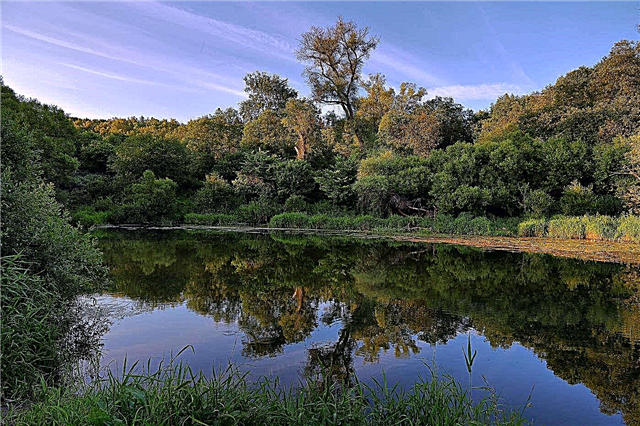
Kayaking routes are organized along many large rivers in the region. These rivers have a small slope, so the flow in them is not fast. There are many convenient parking places on the banks of the rivers. Most of the region's rivers are rich in fish. There are many berries and mushrooms in the forests around. The picturesque nature of the river banks will not leave anyone indifferent. On weekends, residents of Kaluga often come to rest on the rivers of their region.
The longest rivers in the Kaluga region
List, photo with names and descriptions of the largest waterways in the region.
Oka
It flows through several large areas. In addition to Kaluga, on its banks are the cities of Orel, Ryazan, Murom. Nizhny Novgorod is located at the mouth of the river. During the spring flood, the water rises up to 12 meters. There are many fishing and tourist bases on the shores. Fishermen are attracted by different types of fish - roach, pike perch, ide. Various paid services are provided, including equipment rental.
The length of the river is 1,500 km, in the Kaluga region - 180 km

Ugra
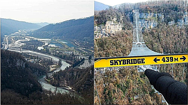
This river flows in the Kaluga and Smolensk regions. The river is considered a reserve, no hydroelectric power station is built on it, there are no reservoirs. Another feature of it is the multitude of archaeological finds. Find traces of outposts and battles. At the mouth of the river there is the Church of the Savior on the Ugra. The Ugra National Park with the Yukhnov Forest is spread on the banks. There are many picturesque lakes and small lakes in it. The width of the river does not exceed 40 meters.
The length of the river is 399 km, in the Kaluga region - 160 km

Protva
This river begins in the village of Mokroe, Moscow Region. It flows into the Oka near Serpukhov. Historical excursions are popular along the banks of the river. Objects of inspection are ancestral noble estates, Pafnutyev-Borovsky monastery. The depth of the river reaches three meters, and on the rifts it is only 0.2 meters. Protva is one of the most spring-loaded rivers in the Kaluga region. There are many fish in its waters, the river is popular with fishermen.
The length of the river is 282 km, in the Kaluga region - 150 km

Zhizdra
Oka tributary. The source is located in the swamps near the town of Lyudinovo. It flows through a wide valley in which it forms many lakes. The river is 2.5 meters deep and 60 meters wide. Burbot, perch, bream, pike perch are found in the river. The bottom is sandy or silty, rocky in places. The river is popular among fans of kayaking. One of the interesting sights on the banks is Optina Pustyn.
River length - 223 km

Puddle
The name of the river does not have a disparaging connotation - it is a term meaning "a puddle filled with water." The puddle is a flat river, so its flow is slow. The nature by the river is far from noisy cities. This is appreciated by people who come to its shores to relax, swim or fish. The banks of the river are wooded, but there are also open places, meadow glades. There are practically no swampy shores.
The total length of the river is 159 km

Shan
Part of the river is called the Big Shan by the locals. Among tourists, it is considered the most beautiful river in the Kaluga region. There are practically no settlements on the banks of the river. But tourists and fishermen often come here, many come by train. There is a swampy area on the shores, so independent tourists should be careful when moving around. Also, due to dampness, it is difficult to make a fire.
The total length of the river is 131 km

Resset
Its landscape is a natural monument of the region. The Resseta runs along the border of the Kaluga and Bryansk regions and flows into the Zhizdra River. In high water, the upper reaches of the river are popular for rafting. In summer, rafting routes start from the village of Krasnoe. The river bed is not wide. There are many fish in the clear waters of the river, and many berries and mushrooms in the forests on the banks. Resting on the river is popular among families with children.
The total length of the river is 123 km

Serena
Inflow of Zhizdra. Small but fast river. The river is only 25 meters wide and 1.5 meters deep. The waters of the river are clean and transparent. The river takes its mouth from a spring near the village of Pokrov. The riverbed is meandering, its loops form a picturesque landscape and are attractive places for fishing. In summer, the river almost does not dry up, remains abundant, feeding on groundwater and springs.
River length - 108 km

Sukhodrev
It flows near Kaluga - only 20 km away. This is convenient for kayaking enthusiasts who often come to the river on weekends. On the lower section of the river, there are practically no river inhabitants. In 2018, one of the enterprises dumped waste into the river waters, and up to 90% of the fish died. However, in the upper reaches of the river, fishing for chub with a line is popular. During floods, the Sukhodrev river overflows and floods summer cottages.
River length - 96 km

Tarusa
The banks of the river are mostly covered with mixed forest. It houses the Bobrovy Cape National Park. Many families come to these beautiful places to swim and sunbathe. In the upper reaches, the width of the river reaches 7 meters, in reaches up to 30 meters. The average depth is 1-2 meters, in some places it reaches 5 meters. There are deep pools in the areas of abandoned mill dams.
River length - 88 km

Sheaf
This river originates from the village of Tserkovshchina. It is a tributary of the Desna. A sheaf will delight the lake in the middle of its course. Most of the banks of the river are covered with forest and bushes. The banks are mostly gentle. Sheaf is a spawning ground for sturgeon and salmon fish. More than 10 settlements are located on the banks of the river. But there are no industrial facilities and sewage. The water is clean.
The total length of the river is 86 km

Bryn
Tributary of the Zhizdra River. On the banks there are interesting objects for inspection - a church built in the 19th century, a wine museum, merchant houses. The river world of the river is diverse, but tourists complain that part of the bank is closed by fences and fishing is possible only for a fee. Forests on the banks of the river were previously called Brynskiy and were mentioned in ancient epics. Now these forests are popular among mushroom pickers and hunters.
River length - 81 km

Popolta
The river flows in two regions - Smolensk and Kaluga. In summer, the Popolta River looks like a shallow stream with a fast flow. The places are quiet. Hunters and fishermen often come here. Fish is good here. The banks are wooded. The river is terraced, with rifts every 100-150 meters. There are many fallen trees and debris that beavers arrange. Because of this, the river is poorly suited for rafting.
The total length of the river is 74 km

Beast
The influx of the Ugra. It starts from the lake near the village of Fokino. The river is shallow. Large fish are not found in it, but there are many small fish in it. It is caught in wide places. Izvert is a lowland river with a slow flow. It mainly flows in open areas. There are wooded banks. There are many small settlements along the banks. The river has several tributaries up to 50 km long.
River length - 72 km

Squeeze
Left tributary of the Bolva River. It flows in a southerly direction. Low water. During the spring flood, the water level rises slightly. Tourists who come to rest on this river note the pleasant atmosphere of these places. The evening hardly blows, the air is clean, tall trees grow. But ticks and mosquitoes live in the forests. The course of the river is slow; in summer, the river dries up in some places.
River length - 65 km

Medynka
It is a tributary of the Sukhodrev River. The city of Medyn is located on its banks. The river begins in the tract. The forest area is swampy there. The course of the river is meandering, its direction often changes. Flowing through the forest area, Medynka collects the waters of shallow tributaries - small rivers and streams. The river is shallow, but in some places there are deep backwaters with beaver dams.
River length - 51 km

Pereksha
Tributary of the Popolta River. One of the attractions on the banks of the river is the settlement of Spas-Pereksha - an ancient fortified settlement, an archaeological monument. It starts at the village of Vizichnya in a swampy area. The mouth is located near the village of Pochernino. Several small rivers flow into the Pereksha River. Also, the river is fed by springs and melt water.
River length - 50 km

Vysa
Vysa is a tributary of the Oka. It has two tributaries - the Tirekreya and Loknya rivers. It flows through the Ugra National Park. It has mineral springs and springs, equipped for the convenience of visitors to the park. Beavers live on the river. The waters of Vyssa are inhabited by pikes, roaches, and perches. Fishing is prohibited during spawning in special spawning grounds. There are places for beach recreation on the river.
River length - 50 km

Lovatyanka
The source is located near the village of Ozerskaya, then the river flows to the east. It flows into the Resseta River. Lovatyanka has one tributary - the Gremsha River. Among the inhabitants of the river banks there are such animals and birds as the white stork, Russian desman, river otter and red-bellied toad. Some of the inhabitants are included in the Red Book of the Kaluga Region. The vegetation of the forest is represented by forests, meadows and small shrubs.
River length - 45 km

Big Birch
It is believed that the name of the river is associated with the vegetation on its banks. The river is shallow, for the most part flows along the plain. It feeds on rain and melt water. The current is slow, calm. Its speed is 0.2 m / s. The average depth does not exceed two meters. There are almost no settlements on the banks of the river. The place is quiet and calm. Well suited for unity with nature.
River length - 42 km