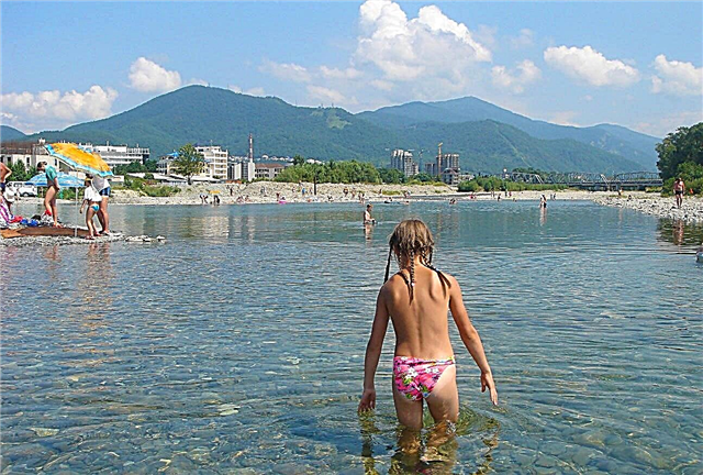
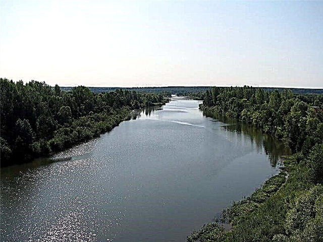
The territory of the Udmurt Republic is covered with a dense and well-developed river network. It includes more than 8 thousand large and small rivers with a length of 20 thousand km. All of them, mainly flat, have a relatively calm current. The heart of the hydrographic network of Udmurtia is located on the Verkhnekamsk Upland. It is here that the sources of 2 large Russian rivers lie - Vyatka and Kama.
The richness of the water system is explained by the peculiarities of the climate in the republic. Precipitation falls here many times more than moisture evaporates. Their maximum falls on the summer period, and only a third falls in the form of snow. Therefore, the rivers in the republic are full-flowing. As a rule, they are not navigable, with the exception of Kama and Vyatka, they do not have important economic facilities. They are used for boating, recreation and fishing.
The longest rivers in Udmurtia
List, photo with the names and descriptions of the main rivers flowing through the region.
Kama
Starts in Udmurtia, near the village of Kuliga. Crosses the Kirov region, Perm region, Bashkortostan, Tatarstan. It receives over 70 thousand tributaries. It flows into the Volga in the vicinity of the Kuibyshev reservoir. Large navigable artery. Ports - Sarapul, Kambarka, Perm, Naberezhnye Chelny and others. 3 reservoirs and hydroelectric power plants have been built. There are many historical and archaeological monuments along the banks. It is famous for its abundance of fish.
The length of the river is 1805 km.

Vyatka
A large tributary of the Kama River. The source of the river and an insignificant part of the current are located in the marshy area of the northwestern part of Udmurtia. Vyatka is a flat river, the channel of which is characterized by meandering and gentle banks. The river flow is slow, there are rifts. The nature of the shores is beautiful and varied. There are caves and small waterfalls on the slopes of the river valley. It flows in the republics of Udmurtia and Tatarstan, the Kirov region.
The total length of the river is 1314 km.

Cap
It begins in the Perm Territory, then flows through Udmurtia and the Kirov region. It has over 60 tributaries. The river valley is densely populated, there are many swamps, lakes, oxbows, islands. The best flooded meadows in Udmurtia are located on Chepets. Near the village of Polom there is an abandoned hydroelectric power station. Remains of settlements and ancient burial grounds have been preserved along the banks. The river is rich in fish. It flows into Vyatka near Kirovo-Chepetsk. It is navigable within the Kirov region.
The total length of the river is 501 km.

Kilmez
It starts on the Verkhnekamsk Upland, near the village of Malyagurt. Covers districts of Udmurtia and Kirov region. It has 25 tributaries, the main ones being Ut, Vala, Arlet, Lumpun. It flows into Vyatka near the village of Ust-Kilmez. The basin is characterized by woodedness and swampiness. There are several wildlife sanctuaries along the banks. It is popular with water tourists.
The length of the river is 270 km, in Udmurtia - 195 km.

Izh
It originates from the village of Malye Oshvortsy. It flows through Udmurtia and Tatarstan. It has 62 tributaries, the main ones being Bobinka, Agryzka, Kyrykmas, Pozim. On the coast is the city of Izhevsk - the capital of the region with interesting sights, in this place a dam was built on the river and a large Izhevsk pond was formed. It flows into the Kama, the mouth is flooded by the Nizhnekamsk reservoir. It is famous for its fish diversity; beaver populations live along the banks. Rafting routes have been developed.
The total length of the river is 259 km.

Siwa
It flows through the Perm Territory and Udmurtia. Starts in the Chastinsky district of the Perm region. The channel is winding, there are many bends and oxbows. Large tributaries - Votka, But, Lyp, Black. Settlements - Votkinsk, Pervomaisky, Gavrilovka, Siva. It flows into the Kama near the Votkinsk hydroelectric power station. Valuable sturgeon breeds spawn at the river mouth. The Nechkinsky National Park is located in the vicinity.
The length of the river is 206 km, in Udmurtia - 72 km.

Vala
It flows through 3 districts of Udmurtia and the Kirov region. It starts near the village of Porshur, on the Mozhginskaya Upland. There are many tributaries, the main ones are Inga, Uva, Kylt, Nylga, Idyk. The channel is meandering, along the course of the current it forms bends, backwaters, islands, oxbows. Settlements - Vavozh, Starye Kaksi, Cheryomushki, etc. In the Kirov region it flows into the Kilmez. There are ideal conditions for river rafting, several routes have been developed.
The total length of the river is 196 km.

Lumpun
The source is located in the Kirov region, near the village of Urai. Further, the river flows south through the territory of Udmurtia. It has many tributaries, including the Lemka, Irzek, Andyk, Pushkets, Yaranka and others. It flows mainly in the forest zone. In the lower reaches, it forms many bends, backwaters, oxbows. It flows into the Kilmez River near the village of Balma. It is considered one of the cleanest rivers in the republic. River rafting is popular.
The total length of the river is 158 km.

Lecma
It starts on the Krasnogorskaya Upland, near the village of Shakhrovo. It flows through three regions of Udmurtia. The main tributaries are Chura, Sada, Lema, Pazhma, Upper and Lower Surzi. Settlements on the coast - Shakhrovo, Yukamenskoye, Mustai, Vortsa, Ukan and others. The river bed is winding, in some places overgrown with willows, in the upper reaches there are several dams and dams. It flows into Cheptsa near the village of Ust-Lekma. Fishing is popular.
The length of the river is 127 km.

Vine
It originates in the Yakshur-Bodyinsky region of Udmurtia. Then it flows through the Igrinsky district. The main tributaries are the small rivers Ita, Nyaz, Salya, Utemka. In its upper course, the Vine passes through an uninhabited forest area. Areas in the middle and lower reaches are quite densely populated. One of the largest settlements on the coast is the village of Igra. 3 km from the village of Polom, the Loza flows into the Cheptsu River.
The length of the river is 127 km.

Toyma
It flows through the territory of Udmurtia and Tatarstan. It starts from the village of Stary Bereznyak. The banks are mostly low, treeless, overgrown with bushes, alder, willow. It has 35 tributaries, the main ones being Koltymak, Vozzhayka, Yurashka, Karinka, Alnashka. A rafting route runs along the river from the village of Alnashi. In Tatarstan, Toyma is declared a natural monument. Near the town Elabuga flows into the Kama.
The length of the river is 121 km, in Udmurtia - 40 km.

Uva
It originates in a forest, 2 km from the village of Zinovy. It flows through the territory of two regions of Udmurtia - Uvinsky and Vavozhsky. The main tributaries are Uyvaika, Multanka, Izeika, Purga, Kilcemka. There are two regional centers on the coast - Uva and Vavozh. It flows into the Vala river. The ecological situation on the river has recently deteriorated, due to the lack of treatment facilities, fish periodically die en masse.
The length of the river is 112 km.

Ita
The source of the river is located in the middle of the hills of the Tylovaiskaya Upland, near the village of Zyuzino. It flows through the territory of 3 districts - Sharkansky, Debessky, Igrinsky. The banks of the river are steep and wooded in places. The riverbed is winding, there are shoals and fragments of dams of old mills. Areas in the middle and lower reaches are densely populated. One of the largest settlements is the village of Zura. 4 km away, Ita flows into the Loza.
The length of the river is 108 km.

Kyrykmas
It starts on the Sarapul Upland, near the village of Sokolovka. It flows through 3 regions of Udmurtia and one region of Tatarstan. It crosses the borders of these two republics three times. The main tributaries are Kalmashka, Osk, Bisarka, Bima, Kady. The river is shallow, but abounds in pools. Kayaking trips are practiced, several rafting routes have been developed. Fishing is popular. On the territory of Tatarstan, it flows into the Izh River.
The total length of the river is 108 km.

Duck
The source of the river is near the village of Shakhrovo, on the Krasnogorsk Upland. Crosses the territory of Krasnogorsky and Seltinsky districts. It flows through spruce and birch forests, and is fed by many forest springs and streams along the way, so the water in the river is clean. Settlements - Kurya, Big Chuvash, Big Seleg and others. In the area of the village Selty flows into the Kilmez River. Traces of pagan sanctuaries have been found on the coast.
The length of the river is 107 km.

Go away
The source of the river is located in the taiga on the Krasnogorsk Upland. The width of the river is small - on average, it ranges from 10 to 15 meters. The steep banks reach a height of 3 meters. Most of the shores are covered with bushes, partly with forest. The riverbed is winding. A good catch is possible along the entire length of the river, but experienced fishermen especially praise the area between the mouth and the village of Palagai.
The length of the river is 100 km.

Umyak
It starts at the Mozhginskaya Upland. The settlements are located mainly on the right bank of the river, the left bank is covered with dense forest. The small depth of the river does not allow it to be used for navigation. There are peat bogs in the Umyak floodplain, which makes the river waters appear dark. The river is inhabited by gudgeon, soroga, dace, burbot, chub. It flows through the republics of Udmurtia and Tatarstan.
The total length of the river is 85 km.

Nylga
The upper and middle reaches of the river pass through dense forests. In the lower reaches, on its banks, there are several villages and hamlets. In the village of the same name with the river, there are several cultural sites in memory of the Red Army soldiers who died in the struggle for Soviet power. On the banks of the Nylga, bushes of viburnum and wild rose grow in large numbers. Fishing on Nylga is popular mainly among the locals.
The length of the river is 80 km.

Showa (tributary of the Kama)
Tributary of the Kama. The source of the river is located in the Glazovsky district. It flows through the Republic of Udmurtia and the Kirov region. Within Udmurtia, the width of the river reaches 15-18 meters, the depth is 0.8 meters. There are several small settlements on the banks of the river. The river flow is slow, there are practically no rapids and rifts. The gentle banks are covered with bushes, there are many open meadows.
The length of the river is 72 km, in Udmurtia - 30 km.

Luga
It flows through the Kiznersky district of Udmurtia and partly through the territory of the Kirov region. The source is located near the village of the same name. The main tributaries are Yagulka, Uzyuk, Sinyarka, Tyzhma. Settlements on the coast - Kizner, Lipovka, Yagul, Chernovo, as well as the Kochetlo railway station. In the vicinity of the village Ust-Lyuga flows into the Vyatka River. Deposits of curative mud were discovered in the floodplain of the river.
The total length of the river is 72 km.

Sepych
The source of the river is in the Krasnogorsk region, near the village of Ubytdur. Settlements - Lumpashur, Kachkashur, Semenovsky. Near the village of Verkhniy Sepych there is the Sepychevsky spring - a natural monument. The coastal territories are rich in peat, the development of its deposits was carried out in the 40-50s of the XX century. Due to the peat bogs, the river changed its course several times. It flows into the Cheptsa River. The remains of a mammoth were found in the vicinity.
The length of the river is 70 km.

Lema
The source of the river is located in the Kirov region, near the village of Mamonovo. Further Lema flows into Udmurtia, Yukamensky district. The main tributaries are the small rivers Butun, Sultan, Dolgusha. Settlements on the coast - Pyshket, Deryagi, Turchino, Keldyki, Novoelovo, Belyanovo, Abashevo and others. It flows into the Lekma River between the villages of Ust-Lem and Ezhevo.
The total length of the river is 68 km.

Votka
It starts near the small village of Qiongop. It flows through the territory of 3 districts of Udmurtia. Average depth - 0.5-1.5 m. The main tributaries are Sharkan, Kazeska, Chernushka, Shegyanka. It flows into the Siva River. A dam was built on Votka, as a result of which one of the largest reservoirs in Udmurtia was formed - Votkinskiy pond. Popular holiday destination. The city of Votkinsk is located on the banks.
The length of the river is 66 km.

Bima (tributary of the Kyrykmas)
A small river flowing through the territories of two republics - Udmurtia and Tatarstan. Its source is located in the Agryz region, several kilometers from the Nizhnekamsk reservoir. Bima is a tributary of the Kyrykmas River. Oil production is carried out in the southwestern region of the river basin. Bima is predominantly snow-fed, covered with ice from late November to early April.
The total length of the river is 60 km.

Pyzep
It flows through the territory of Kezsky and Balezinsky districts of the republic. The upper tributary of the Cheptsa. It begins on the Verkhnekamsk Upland, near the village of Rakhmal. The main tributaries are Suda, Medma, Dyrpa, Yumizh. It flows through wooded areas, some areas are very swampy. The channel is winding, abounding in pools, in which fish are well caught. It flows into Cheptsa near the village of Bani. In the past, peat was mined on the river, now the quarries are abandoned.
The length of the river is 59 km.